The oceans are the biggest, wildest, least understood part of the planet. But we’re getting to know them better every day, thanks to a host of technologies that are fathoming the depths in new and inventive ways.
Some researchers are capturing things from the sea and transporting them into the lab to study in detail; others are rigging the oceans with novel sensors and devices, or probing them with algorithms. Together, these approaches are offering brand new views of the underwater world, at a time when it’s never been more important to decipher the inner workings of the oceans.
From coral reefs to deep-dwelling jellies, the oceans’ living inhabitants face greater threats from human activities than ever before. The seas are polluted and overfished, marine habitats are being destroyed, and new impacts – such as deep-sea mining – are fast approaching.
Read more about the ocean:
It’s also becoming increasingly clear just how critical the oceans are for the rest of life on Earth. These enormous, ever-shifting waters play a vital role in weather and climate systems, provide food and livelihoods for human populations around the world, and are home to great swathes of unknown biodiversity. In order to understand and protect life on this planet, we have to look to the oceans.
Virtual e-reef builders
Not so long ago, the main way that marine biologists studied coral reefs was to scuba dive for an hour or so at a time and note down what they saw on waterproof slates. Now, during a single dive, they can take photographs that can be stitched together into an intricate, three-dimensional view of the reef.
“It’s underwater virtual reality,” says Prof Stuart Sandin, a marine biologist at Scripps Institution of Oceanography, UC San Diego. “It makes you feel like you’re immersed.”
Using a system with two cameras rigged at different angles, a diver swims up and down a reef as if they are ‘mowing the lawn’. Around 3,000 images taken from a standard 10 x 10m plot are then analysed by computer using a technique known as ‘structure from motion’.
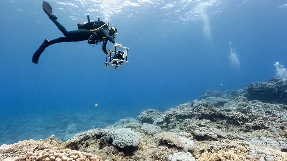
The result for a 10 x 10m plot is a three-dimensional digital model of the reef, made up of a billion coloured dots.
The technique, which took Sandin years to develop by collaborating with teams of computer scientists and engineers, is now being rolled out around the world.
So far, 30 hectares of reef have been mapped, equivalent to dozens of city blocks, at a resolution of one millimetre. Besides producing stunning underwater vistas, all sorts of valuable information can be extracted from these e-reefs.
Read more about coral reefs:
- Corals produce 'dazzling' neon colours to protect themselves from bleaching
- How do corals eat?
- Can coral reefs recover from bleaching?
At Boston University, undergraduate student researcher Coretta Granberry meticulously traces on a digital tablet the outlines of individual corals, so she can calculate their areas and make comparisons over time. “You get a very detailed, intimate image of the reef and how everything is connected,” she says.
The corals she studies are growing thousands of miles away, in the Phoenix Islands in the middle of the Pacific. Her professor, Dr Randi Rotjan, leads expeditions every three to five years to these extremely remote reefs. “Out there, the closest people to you are on the International Space Station,” says Rotjan.
These isolated, protected islands are helping to show how reefs respond to rising sea temperatures. “If you leave reefs alone locally, what are they going to look like when global change is the only stressor?” says Rotjan.
Armed with images taken from the same plots in 2012 and 2015, Granberry and her colleagues will track how the individual corals in the Phoenix Islands change, to see if they shrink, grow or get overgrown by something else.

As time capsules, e-reefs will allow scientists in the future to wind back the clock and answer new questions that nobody can anticipate. “You’re in essence exploring in four dimensions,” says Sandin.
E-reefs are also a powerful tool for showing what the reefs are like right now. “You watch everyone’s eyes glow, from the most seasoned scientists, to a politician, to a community leader, to a child,” says Sandin.
This is especially important in the Phoenix Islands Protected Area, where local people of Kiribati who drove the conservation efforts live too far away to visit the reefs across the enormous archipelago. “E-reefs become the mechanism to show people in country what they’re protecting, and why,” Rotjan says.
Climate change predictors
Between Scotland, Greenland and the eastern coast of Canada, an array of underwater sensors stretches for more than 3,000 kilometres. Prof Penny Holliday from the UK’s National Oceanography Centre describes the array as a picket fence.
She’s the UK principal investigator of OSNAP, the Overturning of the Subpolar North Atlantic Programme, which installed the 58 sensors in 2014. Each sensor consists of a giant, air-filled ball that sits near the ocean surface.
The ball is fixed to the seafloor thousands of metres below via a mooring line. The ball’s buoyancy keeps the mooring line upright, and along the line’s length are various instruments that measure water temperature and salinity, as well as the speed and direction of currents flowing past. The aim is to monitor the subpolar gyre, which is a massive current of warm water that swirls anticlockwise across the North Atlantic.
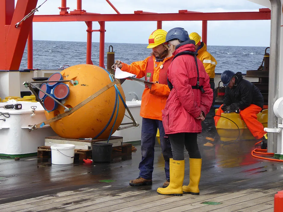
The gyre releases heat to the atmosphere, which flows over the UK and Europe. “That’s what keeps us warm,” says Holliday. We can see this effect by comparing temperatures of the UK or Europe with the same latitude in Canada. The difference is caused by the heat brought to us by that large-scale ocean circulation.
The Atlantic’s subpolar gyre is part of a global process called ‘overturning circulation’. This is the process by which warm, shallow seawater flows from the tropics towards the poles, where it gradually cools, becomes denser and sinks, then flows back towards the tropics again.
It plays a key part in climate models, distributing heat and carbon around the planet, but in the North Atlantic it’s not well understood. Until the array was installed, scientists had no idea how strong the overturning circulation was at this latitude, or how it changed over time.
From the first few years of data, Holliday and her team have begun to get a handle on it. “Even just getting those [first] numbers feels like a huge step forwards,” she says. “The interesting thing we found is just how variable it is.”
Read more about climate change:
- Meet the scientists going to extreme lengths to study climate change
- Christiana Figueres on climate change: “Net zero carbon is our only option”
They also realised they’d been wrong in assuming that the most important place for the overturning circulation was between Canada and Greenland in the Labrador Sea. In fact, the centre of action lies between Greenland and Scotland. “That doesn’t sound very exciting, but it’s important for the way we interpret climate models and the predictions we make about changing climate,” she says.
The OSNAP array will stay in place until at least 2024, to continue monitoring the gyre and boost the confidence of future climate change predictions. Holliday’s team are also bolting on new devices to measure oxygen levels.
“One of the big questions in the world at the moment is an issue of whether the ocean and some shelf seas are losing oxygen,” she says. “We’re able to build on this array that was designed for another purpose to get extra information, which is really exciting.”
Deep-sea curators
Floating through the deep sea are multitudes of intricate, gelatinous animals that are extremely difficult to study. They’re transparent, and so delicate that they easily fall apart when caught in nets. But now a team from the Monterey Bay Aquarium Research Institute (MBARI) in California has developed a new way of looking at them.
Dr Kakani Katija, MBARI’s principal engineer, has designed the DeepPIV (Particle Imaging Velocimetry). Attached to a deep-diving robot, the device uses a sheet of lasers to build 3D scans of transparent, intricate animals in their natural environment.
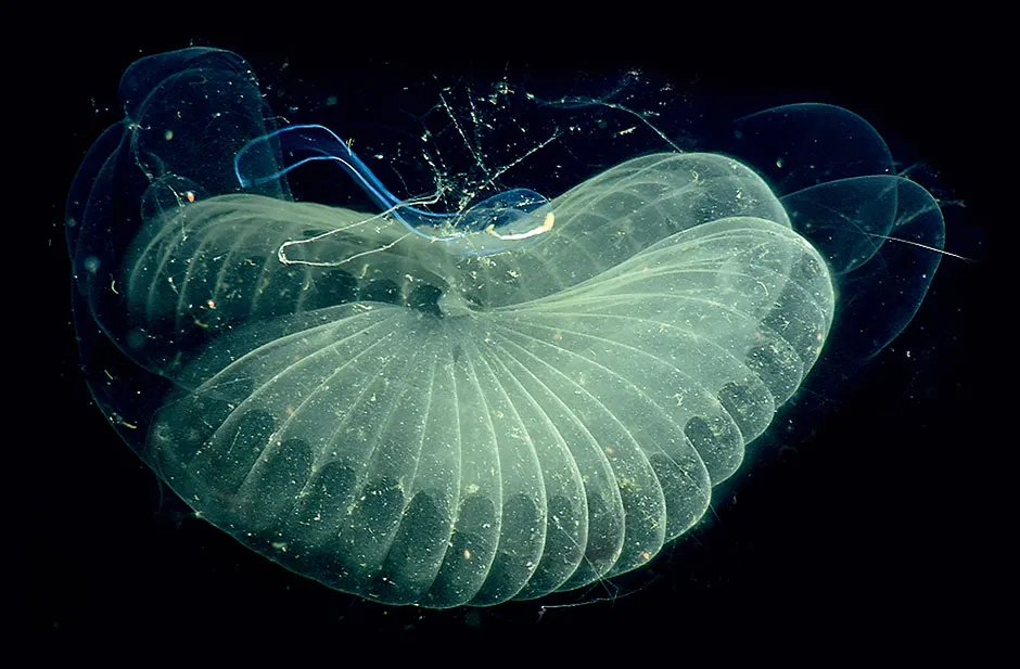
Katija’s first targets were 10cm-long, tadpole-like animals called giant larvaceans, which make complex mucous structures to filter seawater for tiny food particles. The animal’s fist-sized filter looks a bit like a pair of fluted angel wings. “From an engineering perspective, these are some of the most amazing built structures I’ve ever come across,” says Katija.
Her team at MBARI’s Bioinspiration Lab used DeepPIV to scan the inner shape of a larvacean filter, and also tracked particles as the animal beat its tail and drew in water. This information will help them figure out how the filters work and how the animals build them.
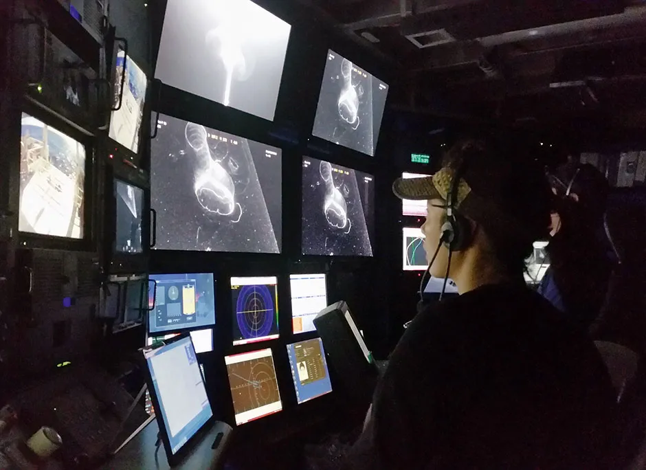
Already, DeepPIV has revealed that larvaceans filter 80 litres of water per hour and absorb masses of carbon-rich food. When they get clogged, the larvaceans jettison their filters, which then sink, therefore helping the oceans to take carbon into the deep. In fact, larvaceans are so abundant throughout the oceans that they play an important role in the carbon cycle.
Other researchers are interested in using DeepPIV, including people who are rethinking ways of exploring the ocean. “These 3D visualisation techniques, coupled to DNA extraction, may be sufficient to describe and catalogue life,” Katija says.
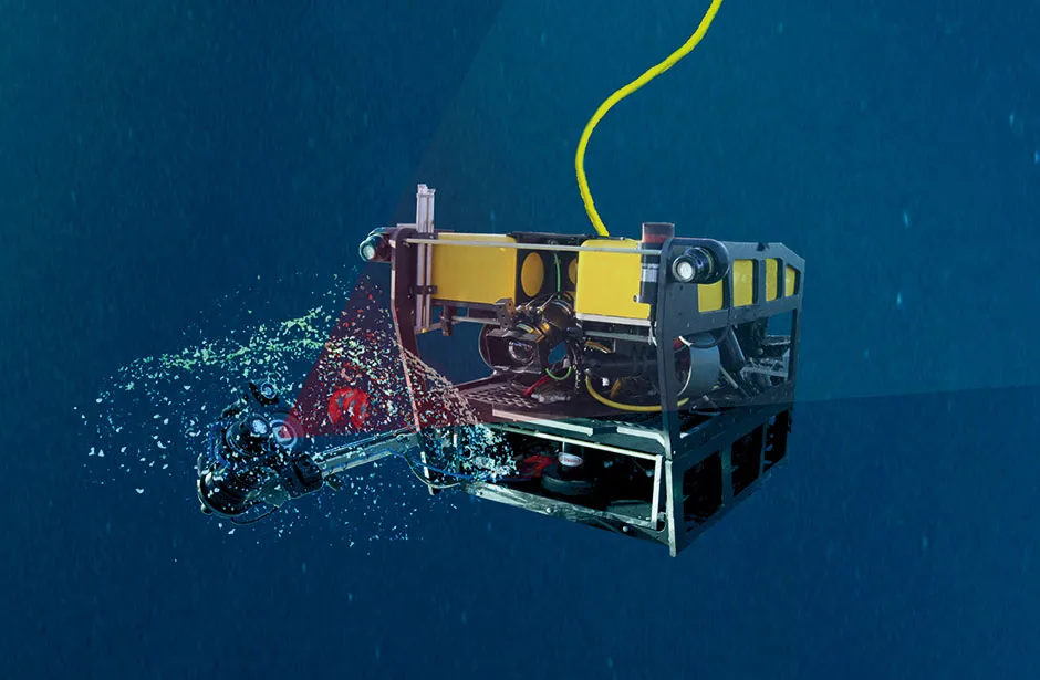
In the future, rather than collecting and preserving dead animal specimens — which is especially tricky for delicate, gelatinous life forms — museums could use 3D scans as digital archives to help describe previously unknown species and document life in the vast deep oceans.
Search and rescue
When someone goes missing at sea, search and rescue plans are usually drawn up using data on weather, currents and water conditions to predict their likely trajectory. The problem is that errors can quickly accumulate until the predicted pathway is a long way adrift from what’s actually happening at sea.
A new algorithm could improve the chances of locating people by predicting not their trajectory, but where they will end up. The algorithm analyses strength and direction of ocean currents, waves and surface winds, and identifies in real-time the regions of the ocean called TRAPs (TRansient Attracting Profiles), where floating objects are likely to converge.
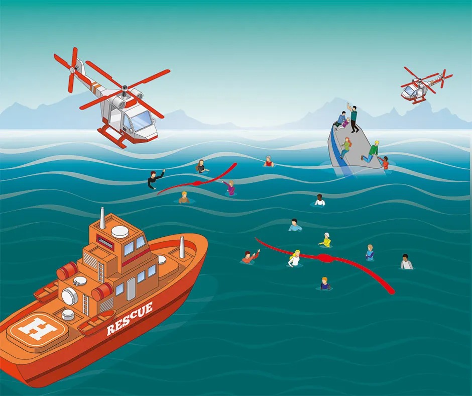
Dr Mattia Serra, now a Schmidt Science Fellow at Harvard, developed the algorithm during his PhD with Prof George Haller at ETH Zurich. He likens TRAPs to a table on which magnets continually pop up, disappear and move.
“Then throw a coin on the table,” he says. “The trajectory of the coin is very chaotic because it’s going to feel the influence of all these magnets.” The table is the ocean surface, the magnets are TRAPs, and the coin is a drifting person.
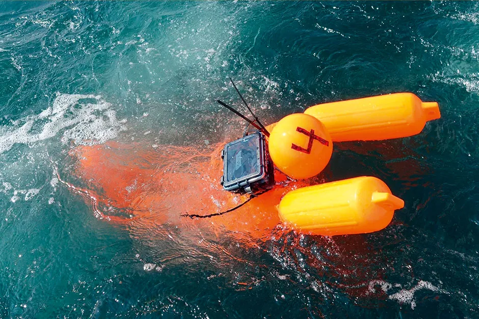
During tests, the algorithm was found to work well out in the turbulent sea off the Massachusetts coast. The team, led by MIT’s Prof Thomas Peacock, used a snapshot of local conditions to model the ocean’s behaviour and locate where the TRAPs were likely forming.
Then they simulated a search and rescue mission, casting buoys and manikins into the sea, each carrying a GPS tracker. As predicted, the objects drifted towards the identified TRAPs.
Serra and his colleagues are now discussing the possibility of the US coastguard using the algorithm in search and rescue operations. The algorithm could also be used to more accurately predict the movements of oil spills.
Microplastic detectors
To tackle the growing problem of plastic pollution in the oceans, it’s vital to know where plastics are, where they move and what they’re made of – especially flurries of microplastics. These tiny plastic particles are smaller than 5mm in size, and can be difficult to find.
“At the moment, if you want to know the distribution of particles in the deep sea you have to sample them,” says Dr Tomoko Takahashi, postdoctoral researcher at Japan Agency for Marine-Earth Science and Technology (JAMSTEC).
Read more about ocean plastic pollution:
- Has Blue Planet II had an impact on plastic pollution?
- Drowning in plastic: can we solve the marine pollution problem?
That takes time, either using nets or water bottles, which have to be hauled up to a ship and sent off for laboratory analysis. Researchers from the University of Southampton, the University of Aberdeen, JAMSTEC and the University of Tokyo, are developing a prototype particle detector that could soon automate the process and help monitor plastics, as well as other tiny particles – natural or human-made – in the deep sea.
Their device consists of a 20cm chamber, which seawater flows along. The chamber contains a single laser, and when a particle is present it scatters the laser light, creating a high-resolution holographic image. This can help to identify the particle, be it plastic or plankton.

The same laser also analyses the chemical make-up of the particle, using a method called Raman spectroscopy. In tests, the device has successfully distinguished between 3mm pellets of polystyrene and acrylic.
The team’s ultimate goal is to produce a fully automated device that could continuously monitor the oceans. Fixed to floats or gliders that cruise around the ocean gathering data, the particle detectors could be deployed for months, even years at a time, beaming back information on the types and abundance of plastics and other particles all through the oceans.
- This article first appeared in issue 353ofBBC Science Focus Magazine–find out how to subscribe here
