1
A sub-sun spotted in diamond dust over Walnut Canyon, Arizona, US
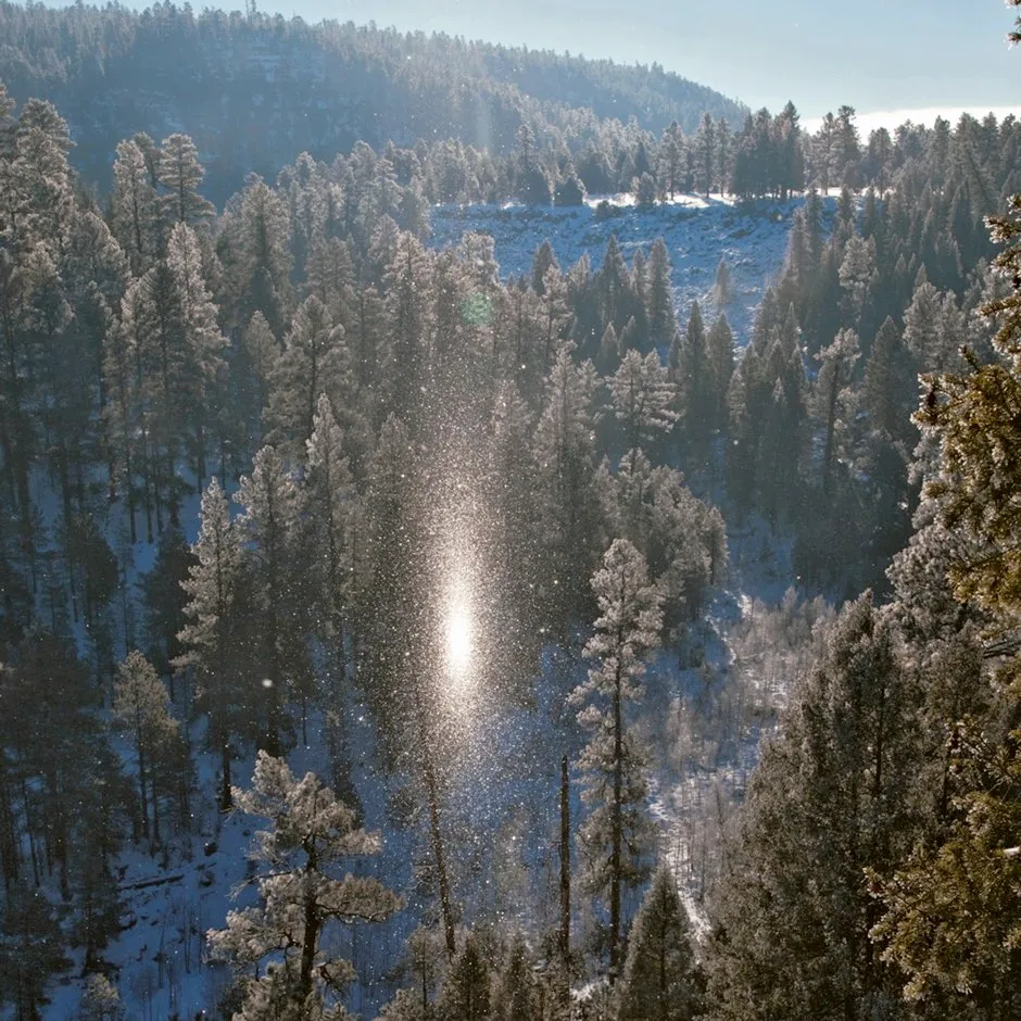
This glowing spectre could easily be misconstrued as a supernatural entity, but its true origin is simple. It is a sub-sun, a reflection of the Sun from the ice-crystal fog known as diamond dust.
The twinkling, low-level crystals form in calm, extremely cold conditions – temperatures of perhaps -20°C or below – when the water vapour in the air freezes into a subtle, tumbling confetti of ice.
Diamond dust shares a lot in common with Cirrus clouds – a lot, that is, except altitude – and like its high Cirrus cousins, this low ice fog can produce a range of different optical effects as its crystals bend and reflect the sunlight.
A sub-sun can appear when you look down onto diamond dust. It is a blurred image of the Sun, formed by the collective sparkles glinting from the tops of countless tiny mirrors of ice.
2
Cumulonimbus with lightning over the Catatumbo River, Venezuela
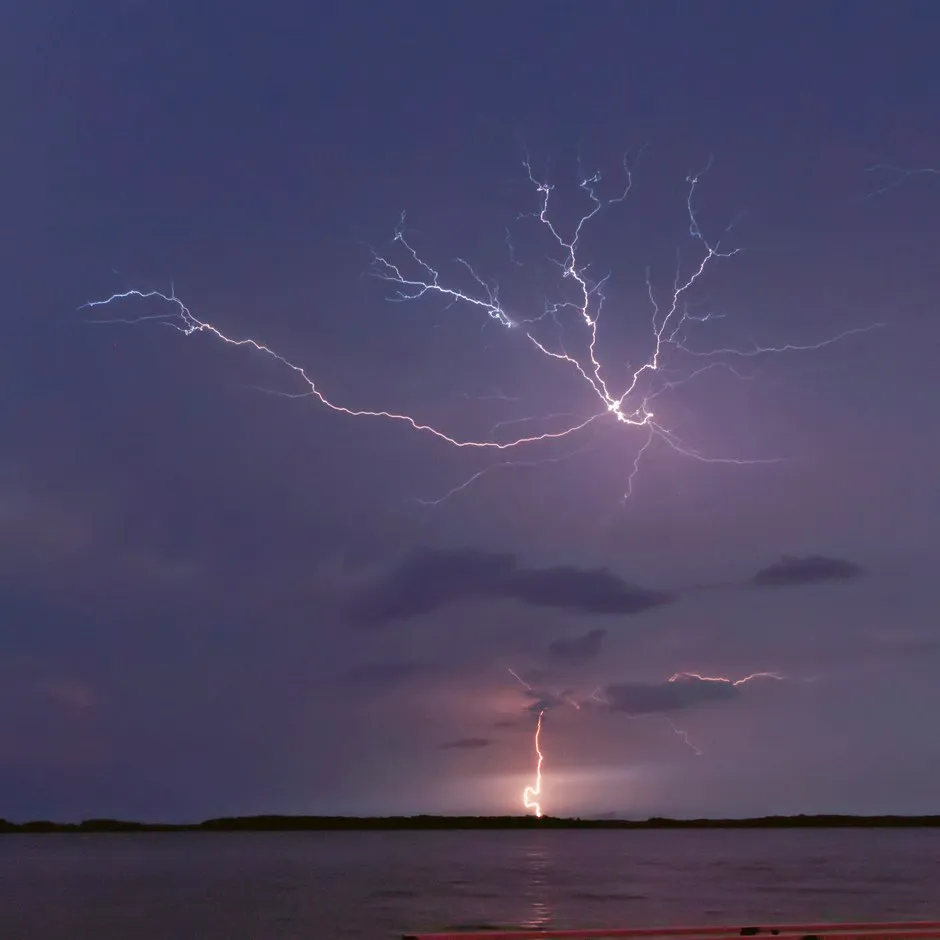
The world’s best lightning displays occur in Venezuela where the Catatumbo River empties into Lake Maracaibo.
These pyrotechnic spectacles are a result of local topography, wind patterns and the location within the globe’s often stormy Intertropical Convergence Zone.
The outstanding feature of the abundant storm clouds over this region is that they occur in the same place and at the same time for nearly half of the nights throughout the year.
The thunderstorms are so high and far enough away from local settlements that they are often seen without any sound of thunder. The silent storms produce so much lightning for up to ten hours a night that the locals need blackout blinds to sleep.
3
Fogbow in Tenerife, Canary Islands
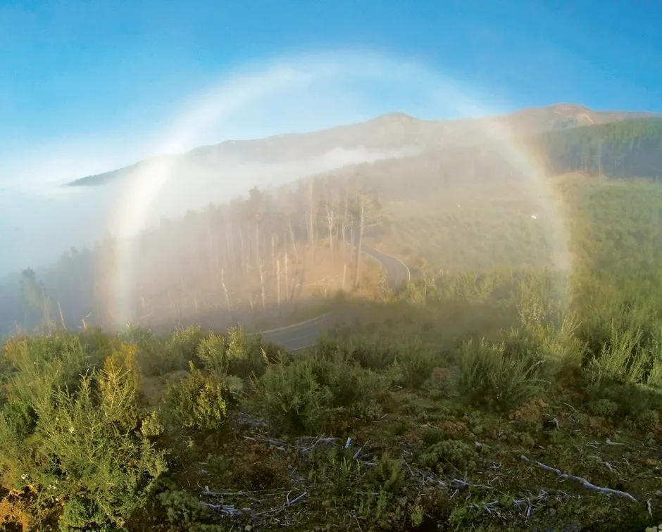
Emily Watson spotted this fogbow on holiday in Tenerife. With a low Sun shining from behind her and a delicate shroud of mist up ahead on the slopes of Mount Teide, the island’s extinct volcano, she knew the moment was right for a fogbow.
Emily headed to a vantage point from where she could look down the line of the sunlight as it shone onto the cloud below.
Fogbows, or cloudbows, are like rainbows produced by droplets far smaller than raindrops. Typically, they are observed looking down onto fog from a mountainside or onto higher cloud from an aircraft.
Also just visible here is a faint ring of colours around Emily’s shadow in the centre of the bow. This is the related optical effect known as a glory.
The fogbow effect was a special sight on what turned out to be a special holiday, on which Emily became engaged to marry.
4
Circumzenithal arc formed by Cirrus vertebratus, Yuma, Arizona, US
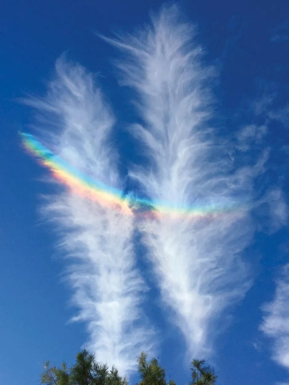
The ice crystals in feather-shaped Cirrus refract the sunlight to produce a circumzenithal arc, the high optical effect whose colours are purer than those of a rainbow.
Either that, or a bird of paradise from the upper troposphere has shed its tail feathers to the wind.
5
Nacreous or mother-of-pearl clouds, spotted over Kells, County Antrim, Northern Ireland
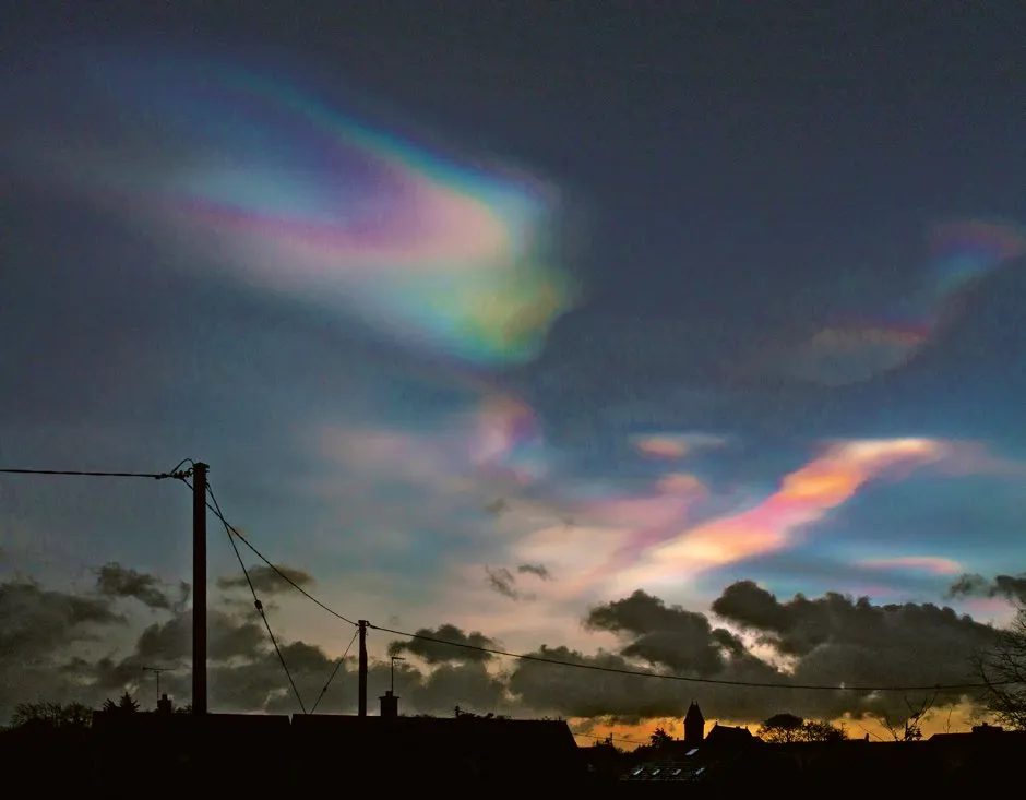
The mother-of-pearl colours of the stratospheric nacreous clouds make them one of the most beautiful formations. But there is a flip side to these pretty clouds.
At altitudes of 10–25 kilometres, they form up at the level of the ozone layer. And guess what? Their frozen particles serve as the perfect environments for the chemical reactions to take place in which the ultraviolet light-shading ozone is broken down by the CFC gasses we released into the atmosphere before their ban in the late 1980s. Damn.
6
Altocumulus lenticularis, spotted over Lake Pukaki, South Island, New Zealand
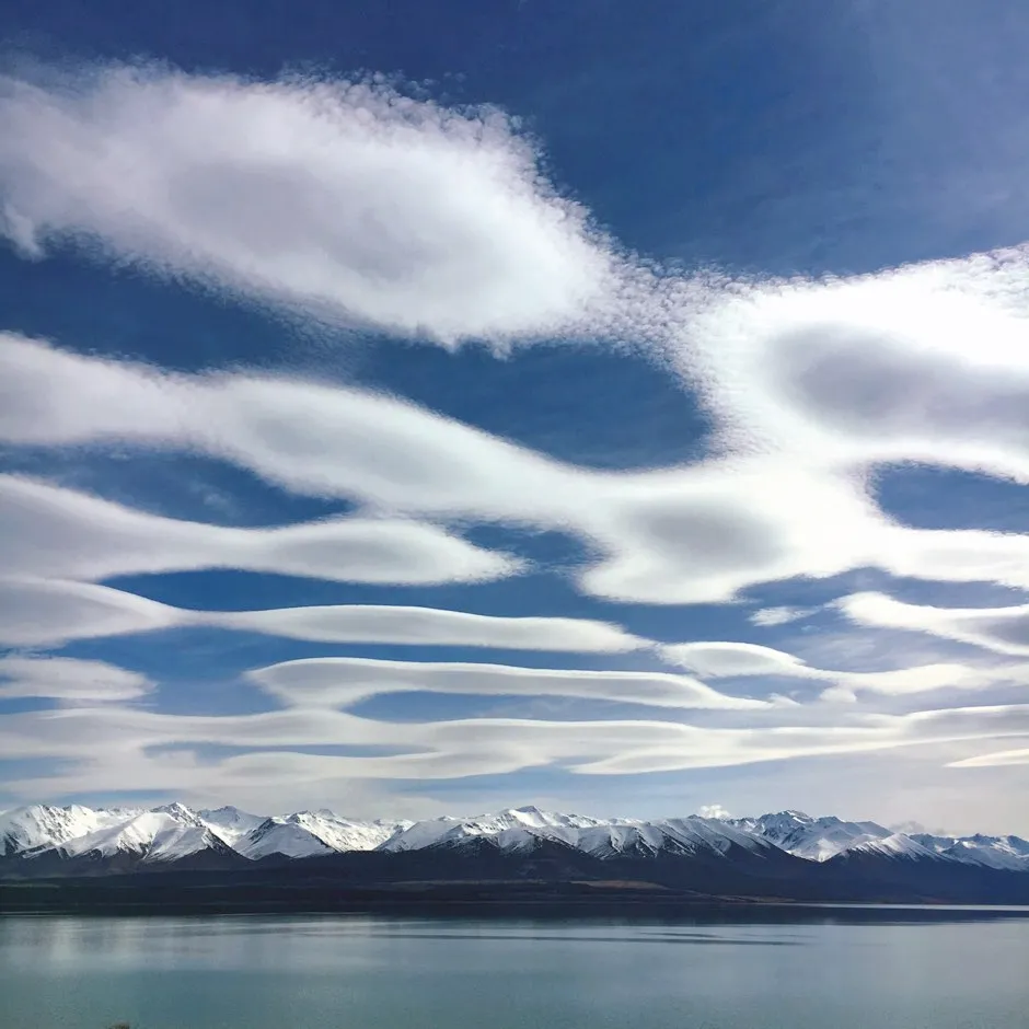
Lenticularis are orographic clouds, which means they result from the interaction between wind and raised terrain like hills or mountains. This display was caused by the Southern Alps of New Zealand’s South Island.
When atmospheric conditions are stable, the airflows downwind of peaks can take on rising and dipping paths. They flow in invisible standing waves of air like those of water on the surface of a fast-flowing river just downstream of a rock. Whenever air rises it expands, and gases that expand cool, so the air cools at the crests of these wind waves.
Such movements are invisible unless air conditions are just right for the cooling to encourage the air’s moisture to condense into droplets. These we see as smooth, saucer- and lozenge-shaped lenticularis clouds hovering in place in the wind.
7
Asperitas in Stratocumulus clouds over Southwick, East Sussex, England
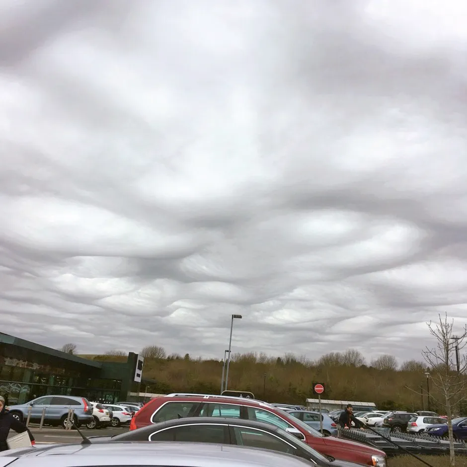
The new asperitas cloud feature, which was first identified by members of the Cloud Appreciation Society, can appear in Stratocumulus and Altocumulus layers. The turbulent and chaotic waves of the rare formation appear mostly in the vicinity of storms.
The classification became official in 2017, thanks to photographs taken not by official weather observers but everyday people who happened to notice the sky when out and about – in the car park, for instance.
Enabled by mobile technology, this new distributed perspective on the sky might eventually turn out to be as revolutionary for our view on the atmosphere as that provided by satellites.
A Cloud A Day by Gavin Pretor-Pinney is out now (£20, Batsford)
Follow Science Focus onTwitter,Facebook, Instagramand Flipboard

