The Pyramids of Giza might be the only Wonder of the World to survive the ravages of time, but planet Earth has had millions of years to form its own selection of natural wonders. And the science behind how these natural wonders formed is almost as incredible as being there. So start saving the pennies and pack your bags, because they really are some of the best places to visit on the planet before you’re buried six feet under it.
The Giant Crystal Cave
Where: Naica Mine, Chihuahua, Mexico
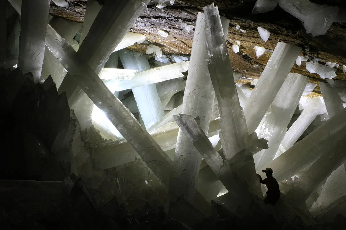
The Cueva de los Cristales as it is locally known, is home to some of the largest single crystals ever found, with its tallest growing to 15m in length and weighing over 50,000kg. The caves position on an ancient fault, five kilometres above an underground magma chamber has promoted the growth of the gypsum (selenite) crystals.
Sulphur saturated ground water is heated by the magma, and oxygen diffuses through the water, subsequently forming sulphate ions. These ions slowly crystallised into gypsum over at least the last 500,000 years, to produce the towering crystal cathedrals inside the caves chambers. Microbial life (potentially new to science) has recently been found here, in the form of dormant organisms trapped in the crystals for up to 50,000 years, who would’ve thrived in the sulphur rich environment of the caves.
Be sure to pack your shorts as temperatures in the cave can reach a sweltering 58 degrees Celsius, with humidity varying from 90-99 percent. Due these extreme conditions, and only being discovered in 2000 by miners, the cave system is relatively untouched, with most explorers unable to endure more than 10 minutes in the heat.
Great Blue Hole
Where: Lighthouse Reef, Belize
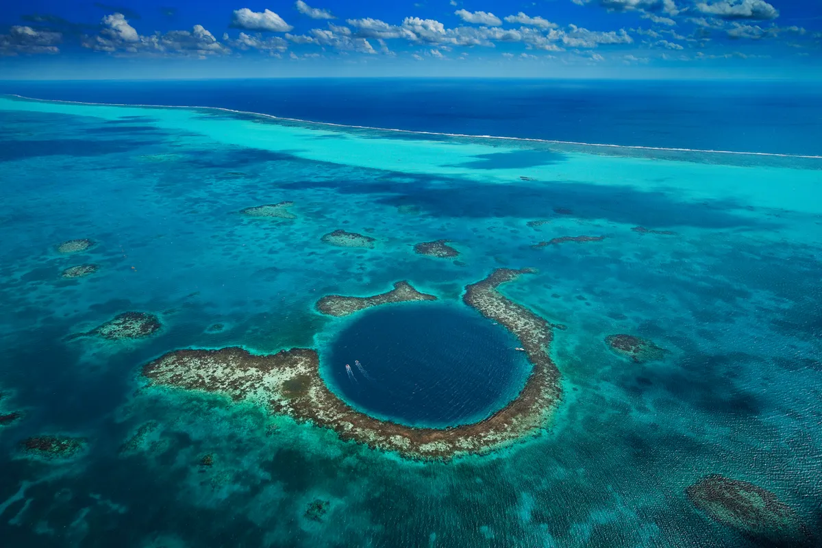
The eerie Great Blue Hole lies 70 km off of mainland Belize and is a perfectly circular submarine sinkhole, with depth of 124m and width of 300m, formed in stages over 153,000 to 15,000 years ago.
The darkness obscures an intricate system of submerged caves, where stalactites indicate that it must have been formed above sea level. During a glacial age the seas were much lower, and the limestone cave was subsequently flooded with the roof collapsing as the sea levels began to rise.
Widely considered one of the best scuba diving spots, the Blue Hole’s crystal clear waters homes many varieties of fish, including the parrotfish and reef shark. The closed environment also offers the perfect nursery for juvenile fish.
Fingal’s Cave
Where: Staffa Island, Inner Hebrides, Scotland
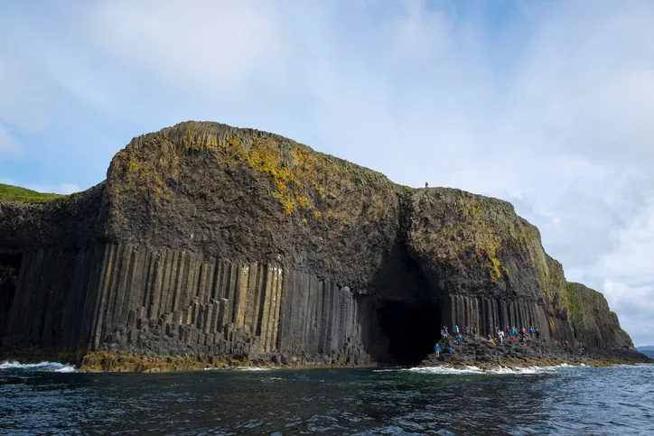
Owned by the National Trust for Scotland, Fingal’s Cave is partially filled by the sea and known for its natural acoustics and colourful hexagonal basalt columned walls. The structure of the cave allows mesmerising sounds to be produced, giving the cave its Gaelic name Uamh-Binn, which means Cave of Melody. Alongside many geological wonders, the majestic pillars of the cave were formed after the cooling of an ancient lava flow, the same flow that created the Giants Causeway in Ireland 60 million years ago. The two sites were likely connected by a bridge of the same material.
The cave system was discovered in 1772 and named after a popular poem from the time, and has inspired imaginations ever since. The fascinating geometric cave was featured in an early song by Pink Floyd and the site was even visited by Queen Victoria.
Bring your sea legs, as the island of Staffa is uninhabited and only accessible by sea!
The Eye of the Sahara
Where: Sahara Desert, Mauritania
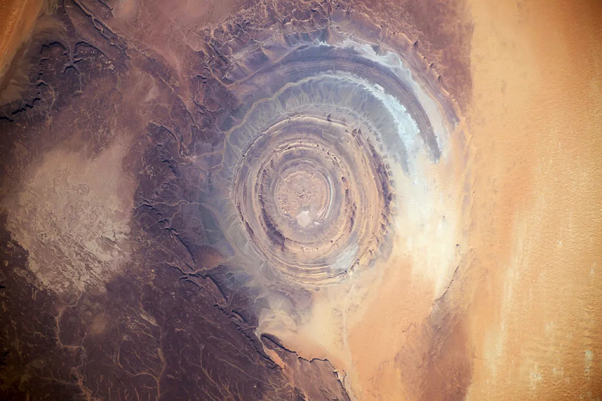
This landmark, in an otherwise featureless landscape, has become a point of reference since the earliest space missions, described by NASA as Earth’s bull’s-eye. The almost perfect circular structure stretches 40 km in diameter, and the radial colour changes are produced by the presence of different sedimentary and igneous rocks.
Also known as the Richat Structure, it was originally thought to have formed from an asteroid impact because of the high degree of circularity. Further study by geologists has revealed that it is in fact an eroded dome, and extensive fieldwork found no evidence of extraterrestrial collision. The site is an eroded maar (a low-lying volcanic crater, which erupts after groundwater comes into contact with magma) and contains quartz-rich sandstone.
Hang Son Doong Cave
Amazing Drone Video Of World's Largest Cave | msnbc (MSNBC/YouTube)
Where: Quang Binh Province, Vietnam
At 200m deep, 5km long and 150m wide, Hang Son Doong has the largest cave passage in the world. The cave system was carved by an underground river, which still flows through the passages, and is estimated to be three million years old, a youngster when it comes to caves.
The cave’s chambers are so vast that they have developed their own weather systems, complete with lingering fog and thick clouds that obscure views of the roof. Vegetation blankets the floor of the cave, achieving the illusion that you are actually outside. The clouds escape through the small openings in the roof, which aided the discovery of this untouched world.
This hidden wonder was only found in 1991 when a local man climbed the steep ascent and stumbled across an entrance to the cave, where he witnessed the cloud plumes leaking from oneof the cave’s chambers. Only in 2009 did a group of British cavers make the site internationally known. Their expedition uncovered the strange environment within, including a 60m tall calcite wall, aptly named the Great Wall of Vietnam, 80m tall stalagmites and baseball-sized cave pearls (a calcium salt formation, where spherical layers of the minerals gradually deposit on a central nucleus to form a ball).
The mysteries of Earth’s caves still remain, as many are unexplored and virtually inaccessible, with more people having been to the moon than these places on our own planet. This cave however, has become a hotspot for adventurous tourists, and since only 500 visitors are allowed into Hang Son Doong each year, there is currently a two-year waiting list.
The McMurdo Dry Valleys
Where: Antarctica

Where is the driest place on Earth? Surely the answer would be a desert, the Atacama desert in Chile maybe? But there is a region that hasn’t seen rainfall in nearly two million years, clearly overtaking the Atacama Desert’s 15 mm of rain a year, making the McMurdo Dry Valleys of Antarctica the driest place on the planet.
The 4,800-square-kilometre region is absent of all precipitation; there is no snow, no water and no ice. The area experiences no rainfall due to the Katabatic winds from the mountains. These winds are saturated with moisture, so gravity pulls them down away from the valleys, giving them an incredibly low humidity.
Photosynthesising bacteria have recently been found inside the interior rocks, and scientists have labelled the area ‘the closest of any terrestrial environment to Mars’.
Antelope Canyon
Where: Arizona, USA
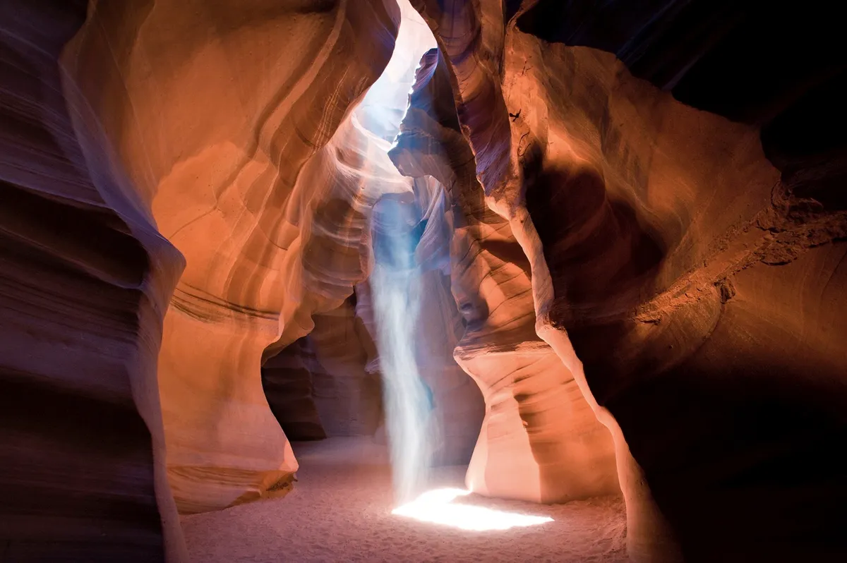
The Antelope Canyon is an example of a slot canyon, which is a narrow canyon deeper than it is wide, formed through erosion by water. The local Navajo name for the site literally translates as ‘the place where water runs through the rocks’, as the area regularly experiences flash flooding, particularly during the monsoon season. The constant bombardment of water has smoothed the edges of the sandstone canyon walls giving them their characteristic ripples. The sunlight cascades onto the orange walls, casting ever-changing shadows on the flowing walls.
The grandeur of this geologic wonder disguises its dangerous environment, as sudden floods from 11km up stream at the canyon basin pick up speed and unsuspecting tourists.
Chocolate Hills
Where: Bohol, Philippines
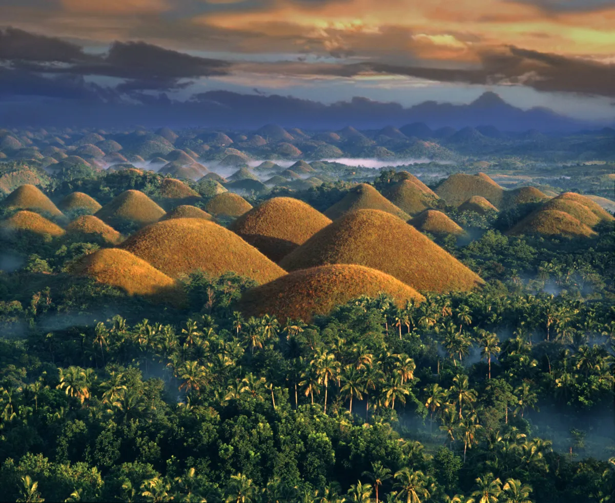
The dried tears of giant after his mortal love interest’s death; the remains of boulders from two giants who fought, then forgot and became friends; the faeces of a giant with food poisoning; these are how the Chocolate Hills were formed - or so the local legends say.
Spread across an area of 50 square kilometres, as many as 1,776 domed hills scatter the terrain of the Bohol province. The hills are made of limestone, with an outer grassy layer, which turns brown in the dry seasons, inspiring their name. The limestone encloses many fossils of marine animals, such as corals and algae left behind from an ancient seabed lifted upwards through tectonic action. The raised seabed was then eroded by rivers, leaving behind the rolling symmetrical domes.
Meteor Crater
Where: West Winslow, Arizona, North America
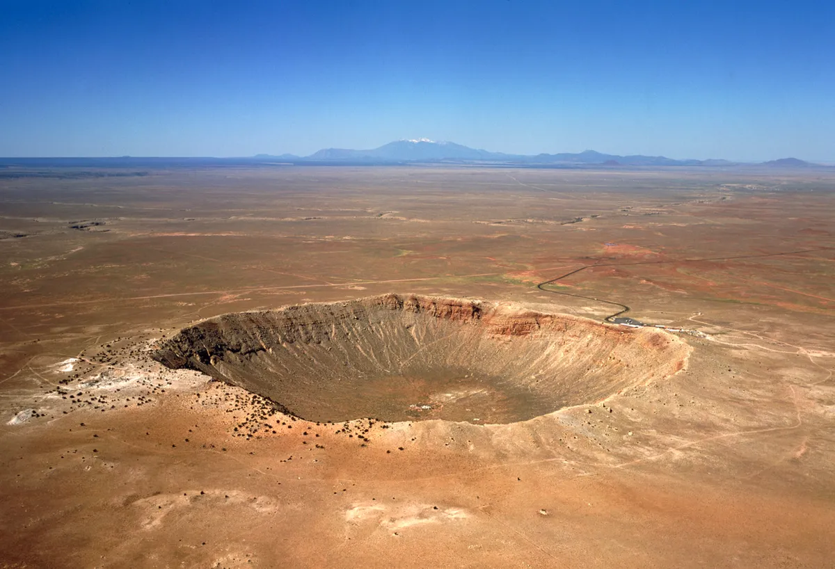
At 1,200m wide, and 170m at its deepest point, the Arizona meteor crater is said to be the best preserved crater on Earth. The crater is estimated at 50,000 years old, so woolly mammoths native to region at the time would have observed the meteor impact. The young age of the crater combined with the dry climate of Arizona has limited most of the natural erosion from occurring since its formation.
The culprit was a nickel-iron meteorite, 50m in diameter, most of which vaporised when descending through the atmosphere, leaving a few fragments in the crater. The identity of the crater was not confirmed until 1960, when rare forms of silica were discovered at the site, types which could only be formed under sudden high-pressurised impacts and couldn’t be the result of a volcanic eruption.
Pamukkale Travertine Terraces
Where: Denizili, Turkey
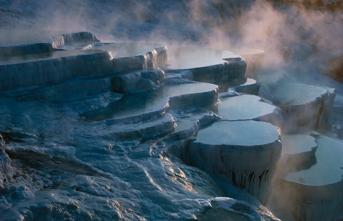
Pamukkale translates as ‘Cotton Castle’ in Turkish and its no wonder why when the landscape resembles cotton or snow-walled pools. The beauty of the area has made it a natural health centre since Roman times.
The tranquil terrace pools are the result of calcium carbonate deposits from hot waters that cascade down the steps, which crystallises as the solid mineral travertine. The hot water creates natural blue springs, warmed to a relaxing 36 degrees Celsius, and this paired with the picturesque view of the surrounding mountains, its clear why this place is thought to have significant health benefits.
Danakil Depression
Where: Afar Triangle, Ethiopia
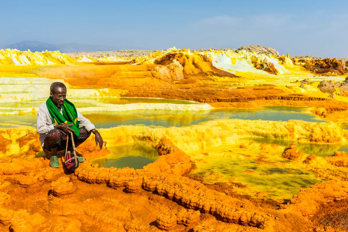
This region of Africa is the hottest place on Earth in terms of its average annual temperatures, without rainfall for most of the year. The rivers dry up producing salt lakes, before ever reaching the Indian Ocean. Many thousands of years ago, the depression would have been part of the Red Sea, but volcanic action raised the surrounding area, blocking the sea to the Danakil region, leaving it to rest 100m below sea level.
Features of great scientific interest in this desolate landscape include the hot sulphur springs, similar to those at Pamukkale. The view is less tranquil, yet fascinating, with acidic waters near boiling point, and green and yellow chimney-shaped mineral deposits, resembling that of an alien world.
These environments in the area have attracted many astrobiologists, investigating life on other planets and moons, due to the presence of extremophilic microbes living in the sulphur-rich springs. By observing these bacteria in the extreme geochemical conditions of the springs, scientists are hoping to determine the limits to life and the possibilities that such organisms can evolve in other places in the Universe.
Salar de Uyuni
Road Trip Across Bolivian Salt Flats - World's Most Dangerous Roads - Series 3 – BBC (BBCWorldwide/YouTube)
Where: Potosi, Bolivia
Legend has it that the mountain giant Tunupa was distraught after her husband left her for another mountain giant. Crying while breastfeeding her child, her tears combined with the milk and dried to form the salt flat of Bolivia.
The formation of the salt flats was not so much a tragic love story, but the result of an uplift of the Andes Mountains. A plateau was created 3,656m above sea level, trapping salt lakes in the rim of the surrounding mountains without drainage outlets. The prehistoric lakes have been covered with a layer of salt crust for the past 10,000 years, a few metres deep, allowing tourists, cars and animals to cross the infinitely flat landscape.
The incomparable flatness and highly reflective nature of the site makes it useful for many space satellites to calibrate their altitude meters. The underlying pools of brine are a rich source of lithium, containing an estimated 50-70 percent of the world’s lithium reserves, which is currently being extracted. Small islands of desert vegetation, such as giant cacti, litter the salt flats as they are the peaks of submerged dormant volcanoes.
Actun Tunichil Muknal
Where: Cayo District, Belize
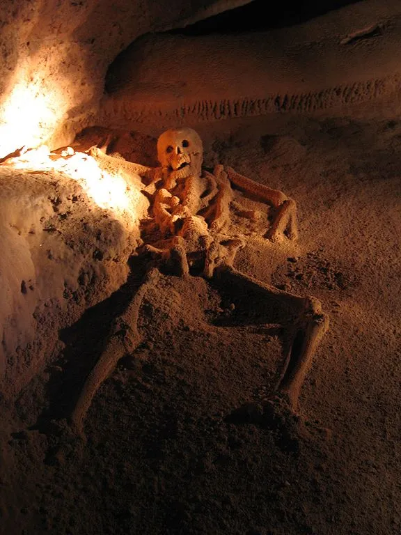
Become Indiana Jones as you adventure through this archaeological wonder, once used by the ancient Mayan civilisation. The cave systems name translates as ‘the Cave of Crystal Sepulchre’, and rightly so, as it is home to ‘the Crystal Maiden’, the calcified remains of an 18 year-old girl, and other skulls. Most likely a sacrifice victim, her skeleton has calcified in the cave’s humid condition to form a crystalline coating on the bones, which sparkle under light.
The cave was carved by an underground river, which ultimately produced a sinkhole above allowing the cave to become accessible. Along with the Mayan artefacts, the cave features impressive stalactites formed by mineral deposits from dripping water, and stalagmites that grow up when minerals are deposited as water drips onto the cave floor.
Socotra Island
Where: Arabian Sea, Yemen
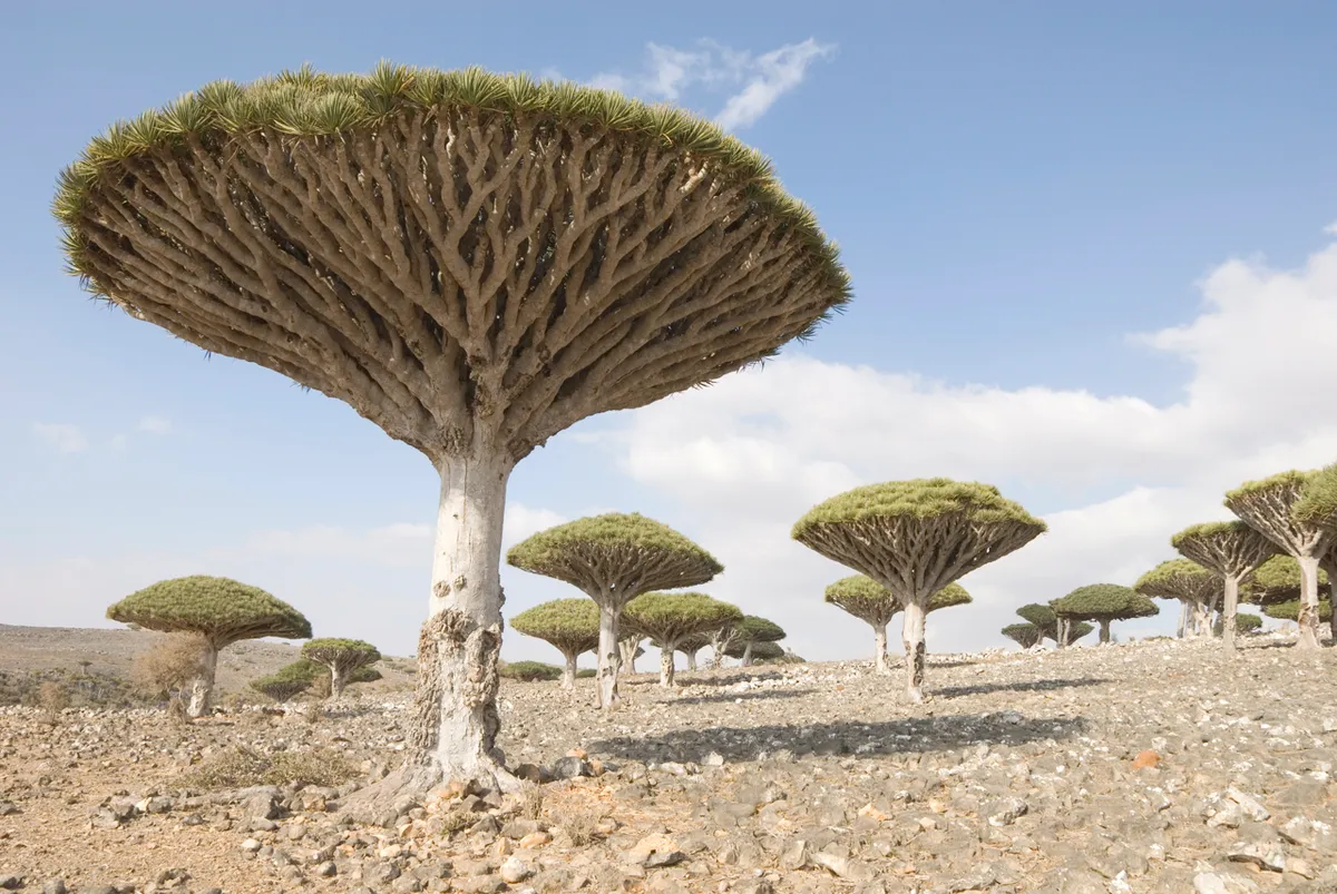
The isolated island of Socotra has been described as “the most alien-looking place on Earth”. The island was once part of a supercontinent, Gondwana, and slowly detached from 23 to 5 million years ago during the shift of the Earth’s tectonic plates, taking unique plants and animals with it.
The island features mountains, is permeated with limestone caves, and has a semi-desert climate. The remote location, heat and constant droughts have forced unique organisms to evolve, including very bizarre looking trees, the majority of which are endemic. With over 37 per cent of its species found nowhere else on Earth, Socotra Island is a treasured peak of biodiversity bordered by the Arabian Sea.
Karlu Karlu
Where: Northern Territory, Australia
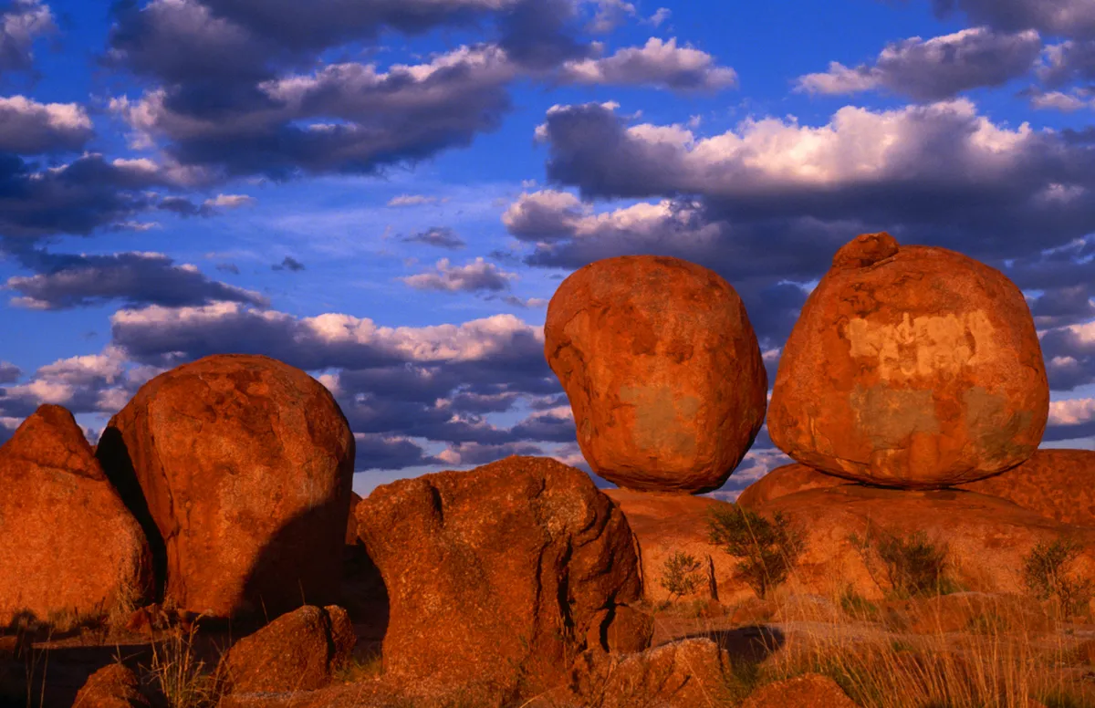
A trek south of Tennant Creek brings you to the sacred site of the ‘Devil’s Marbles’, boulders which look to have been physically balanced on top of each other, and perfectly split apart through industrial tools.
The giant granite boulders are from a larger, now underground, source of granite. Over 1.7 billion years ago, the granite was protected by a layer of sandstone, which gradually eroded naturally, and cracks were produced in the granite due its exposure to the elements. Water invaded these cracks, while weathering continued until the beginnings of the boulders were exposed. Further erosion from rainfall and acidic molecules in the water has given the boulders their characteristic spherical shape.
The area is of great spiritual significance to the aboriginal tribes, and was returned to them in 2008 with its traditional name Karlu Karlu.
Mingsha Shan
Where: Dunhuang, China
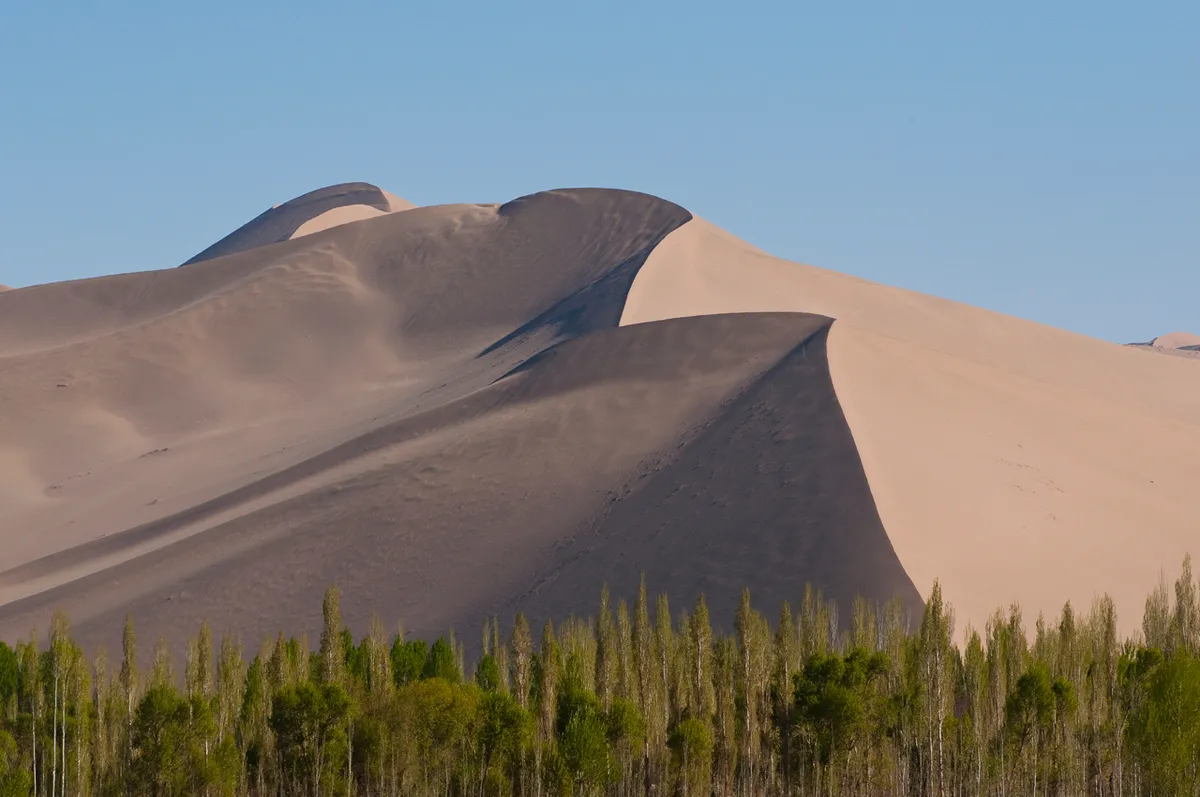
In a desolate landscape, the last thing a traveller would expect to experience is hearing a mysterious low-pitched hum - or the legendary cries of lost souls buried beneath the dunes by an angry dragon. The eerie sound is the ‘song of the dunes’, a phenomena that occurs in 35 desert locations on Earth, including the Mingsha dunes of China.
There are a few specific conditions required for the sand dunes to sing; the grains must be 0.1 to 0.5 mm in diameter, the sand must contain silica and must have a certain humidity. The sound emanates from sand moving down the crescent shaped dunes, known as barchans, when wind passes over the dune or when someone crosses them. The accepted reason behind the spectacle is that the sound vibrations resonate within the layer of dry sand above a slightly more moist layer sand, as it avalanches down the surface of the dune. The song produced is up to 105 dB, as loud as being in the crowd at a sporting event, and can last several minutes before the area will suddenly plunge into an unnerving silence.
Olympic Dam
Where: Gawler Range, South Australia
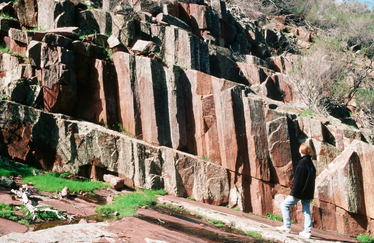
Now the site of a Uranium mine, the Olympic Dam area is home to an ancient supervolcano, estimated to have erupted around 1,600 million years ago. The remnants of such a catastrophic event left behind ‘organ pipes’ - hexagonal columns in the rock face, formed when lava cooled after the crust of the volcano burst.
The surrounding area impacted by the volcano stretches 500km in diameter, and the plains produced by a total lava volume of 500,000 cubic kilometres.
The region has since attracted the mining industry, due to its rich hydrothermal deposits of ore; uranium, as well as copper, silver and gold. At an approximate nine billion tonnes, it is one of the largest ore deposits in the world thanks to the preferable conditions generated by the ancient volcanic system.
Iguazu Falls
Where: Argentina-Brazil Border
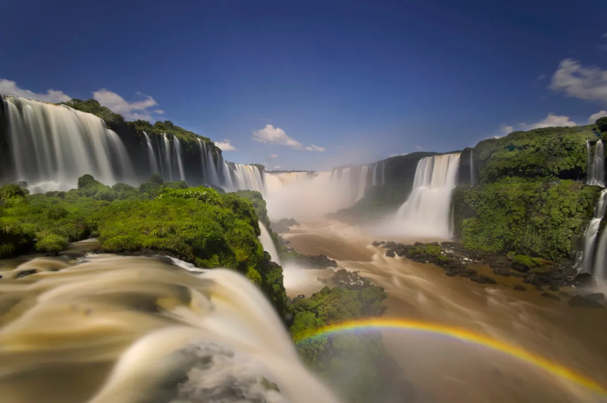
The Iguazu River flows through Brazil before plummeting into the world’s largest waterfall system, the Iguazu Falls. The site is divided by rocks into many separate falls, 150-300 depending on the season and water levels, ranging from 60 to 82 metres in height, with almost half of the water tumbling over ‘Garganta del Diablo’- the Devil’s Throat.
The astonishing sight began to form 135 million years ago, when a volcanic eruption flooded the area with lava, cooling and combining with existing sandstone, transforming the desert land into the basis of the falls. Further tectonic plate movement 20,000 years ago allowed the river to follow the faults and cracks, producing the spectacular Iguazu Falls.
However, the original falls were located 28 km downstream, but the constant bombardment of water has eroded the falls to where they stand today.
Yellowstone Fumaroles
Where: Yellowstone National Park, Wyoming, North America
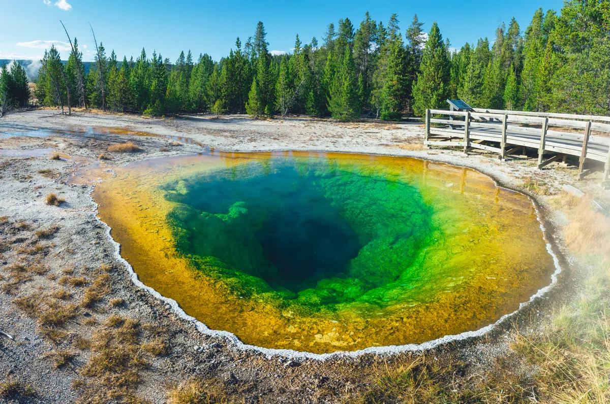
A fumarole is a hydrothermal structure where water is boiled underground by a magma source (indicative of the infamous supervolcanic activity below Yellowstone), producing superheated steam vents of up to 138 degrees Celsius. They are located on hills or cliffs, well above the groundwater levels, which would have a cooling effect on the fumaroles, preventing the water boiling. Along with water vapour, toxic gases are often released, mostly sulphurous emissions which can silently suffocate passers by, so spending short amounts of time at the sites is strongly advised.
An estimated 4,000 of these features scatter the landscape of Yellowstone National Park, depositing brightly coloured minerals around their openings. When the fumaroles become more active, they become hotter and release more concentrated vapours, which are toxic to local wildlife and are often early warning signs of earthquakes.
Similar formations have been discovered on Mars, suspected to be ancient eroded remains of fumaroles, which could have harboured extremophilic microbes once upon a time.
Follow Science Focus onTwitter,Facebook, Instagramand Flipboard
